This blog is primarily setup to record the Digital Information Technologies and Architecture MSc module at CITY.

Monday, 26 October 2009

DITA module 05

XML languages

My initial efforts with XML were to create a DTD and XML using the downloadable XML Marker from http://www.symbolclick.com/ This was to generate a database of Seismic Surveys and Lines.

I do attach it here, but afterwards realised I wasn't using a standard DTD.
http://www.student.city.ac.uk/~abhj012/dita-5-xml-example.mht

The GML/KML languages for GIS have been well developed by the Ordnance Survey and more recently by Google.
The language has been built so as to allow for the entering of geographical features, their location and annotation.

I found the Google website very helpful in it's explanation of how for example the geometry is recorded.

figure 1.

This allows for the entry of points, lines and polygons (as we had been discussing in GIS).

Likewise region is given by latitude, longitude and altitude and is then fixed to a given
number of pixels.
figure 2.

Each element is given its relative minimum and maximum values which will give
the boundaries for the region. For example a region could have a min of 5 degrees west and
a max of 3 degrees east with a min of 55 degees north and a max of 59 degrees north.

DITA module 04

Images and Graphics


Within my web space I have a page of photos from a trip to Greenwich, all these files are JPEG format and have individual tags.


http://www.student.city.ac.uk/~abhj012/GI_Greenwich.html


Image formats differ greatly in the resulting image size, visual quality and compression. An image needs to be large enough to give enough detail, but not so large that it causes a site to open slowly. The quality of the image is very important for GIS but it is possible to loose some detail for the sake of space. For example, a road map can have one colour for the background as the need for elevation information isn't there, but a walking map needs elevation contours and colour differences to show if the area is flat or a steep gorge. Sites like Google with it's map and satellite images need to use the minimum size of files so that they don't slow down the users use of the site, but give enough detail. For the maps there are only a small number of colours used, while for the satellite images there are many more. As you zoom out on a image the number of colours also reduces.


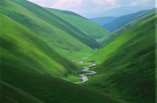
To the right is a picture of a valley, taken from www.asiafrace.com/photos uploaded from Google Images.
The picture is in Jpeg format with a size of 84 KB
The image is clear and all colours are well defined.
The image used JPG compression, where you have the choice of the size and quality of the image stored.


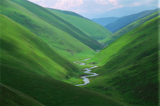
This is the same picture saved in PNG format and is 135KB
The PNG format uses ZIP compression which is lossless.
From the saved JPEG image to the PNG one you can see a
slight difference in the sampling with a smoother image, but one with less contrast.


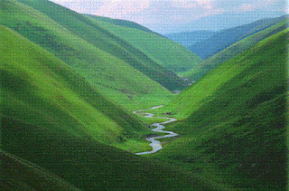
This picture is in GIF format with a size of 38KB
This file is compressed using lossless LZW.
The result is a smaller file but a grainy image.


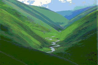
The final image is 256colour bitmap.
The size of the file is 135KB, but the quality isn't good due to the reduced number of colours. The format is uncompressed and stored pixel by pixel.


DITA module 03

Internet and the WWW

The World Wide Web (WWW) is a service which is able to work because of the infrastructure of the Internet, it's history goes back to the early 1990's and was developed for the sharing of information between Universities.

Many establishments have an Intranet, which is only accessible from within the organisation or remotely with restricted access. The Internet is the part of the organisations computer system, often a single server, whose information is accessible to the public.

The use of either intra or inter nets becomes very relevant when producing information for a website which is going to be made public. From within the intranet system it is possible to drag images/files from many locations, which will still be seen. But if you were to publish the site as is, these links would show as broken and not be seen by the public. All the files need to be copied to the public site server or the pages which include the scattered images need to be saved as single MHT files and then be accessed via anchor tags.

I have generated the following web site in Hypertext Mark-up Language (HTML), some editing was undertaken in Microsoft Notepad and some in Unix using vi. It includes further links to first.html, GIS.html and GI_Greenwich.html.

http://www.student.city.ac.uk/~abhj012/index.html


I used the html tutor material, mentioned on my site, to add tables such that I could generate the four columns of information and the two pictures located side by side.

The moving of the different pages for the site was undertaken using telnet (internally) and Secure Shell FTP, SSH (externally).